Causeways
Archaeological features known as “causeways” have been identified in the archaeological record of Ireland, providing insight into prehistoric transportation systems and settlement patterns.
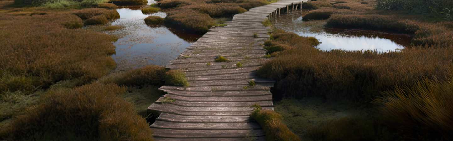
Causeways are pathways or roadways constructed across wetlands, bogs, or other challenging terrains, typically made of stones or other materials that provide stability and support. Examples of causeways in Ireland include the well-known Corlea Trackway in County Longford, which dates back to the Iron Age and is believed to be one of the largest and best-preserved trackways of its kind in Europe. This causeway, measuring over 200 metres in length, was constructed to provide a route across a marshy terrain, and its well-preserved condition has allowed for detailed analysis of its construction and use. Another example of a causeway in Ireland is the well-known Ceide Fields in County Mayo, where extensive stone-lined walls have been identified as part of a prehistoric field system. These walls likely served multiple purposes, including defining property boundaries and providing access to fields and other agricultural lands. Additionally, the walls may have served as a form of drainage, allowing water to flow into designated areas and away from cultivated lands.
In the valley of the River Shannon, the well-known Lough Gur causeway provides a connection between the shore and the island on which the lough is situated. This causeway, which dates to the late Neolithic or early Bronze Age, is believed to have provided access to the island for both transportation and settlement purposes. The presence of standing stones and other prehistoric monuments on the island suggests that it held significant cultural importance for the peoples who used it.
Toghers
In the context of Irish archaeology, a togher is a type of archaeological feature that refers to an ancient road or causeway. Toghers were frequently constructed to provide access to remote or marshy areas and are characterised by elevated platforms or embankments made of stone or wood.
During the early medieval period, toghers were prevalent in Ireland, and many of these ancient roads are still visible today. They are frequently associated with other significant archaeological sites, such as early monasteries, ringforts, and burial mounds, and are therefore of great cultural and historical importance. The construction of toghers was a labour-intensive and intricate process that required a substantial investment of time, resources, and expertise. In many instances, toghers were constructed by communities combining manual labour and animal power to transport materials and construct roadways.
Toghers were frequently constructed to be resilient and long-lasting, and many of these ancient roads have lasted for thousands of years. In some instances, toghers have been discovered to be well-preserved, with visible raised platforms and embankments despite the passage of time. The study of toghers yields significant insights into the early history of Ireland and the ways in which the landscape evolved over time. By analysing the techniques and materials used to construct toghers, archaeologists can gain a better understanding of the technological and engineering abilities of the early medieval Irish.
In addition, the study of toghers provides valuable insight into the social and economic relationships between early medieval Irish communities. Archaeologists can learn about the connections between different settlements and the regional patterns of trade and exchange by examining the routes of toghers.